
Zoe Braun · 3 September 2026
Quilby's Underground Streams Influence Modern Zoning and Transit Planning Decisions
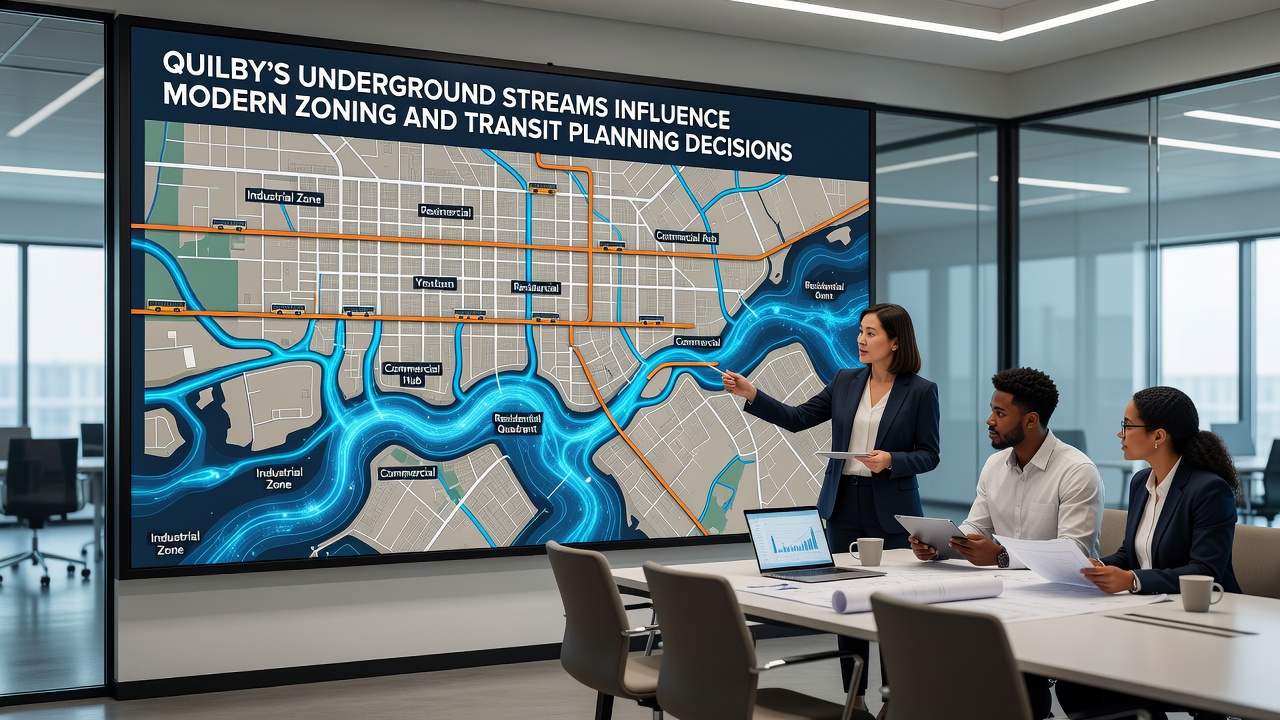
Quilby's network of underground streams has shaped urban development patterns for decades, and city planners continue to adjust zoning maps and transit corridors based on hydrological data collected from monitoring stations installed throughout the downtown core and surrounding districts. These hidden waterways, remnants of pre-industrial drainage systems, create variable soil conditions that affect building foundations, stormwater management requirements, and route alignments for new rail and bus lines.
Hydrological Mapping and Early Planning Adjustments
City engineers first documented the extent of these streams in the 1990s through a series of borehole surveys and dye-tracing tests, and the resulting maps now serve as reference documents for every major infrastructure project. Data from the Quilby Water Resources Department shows that several streams run parallel to existing subway tunnels, creating pressure points where water infiltration has required additional waterproofing measures during recent maintenance cycles.
Planners reviewed updated stream location data before approving the 2024 transit expansion plan, and they shifted one proposed station location two blocks eastward to avoid a high-flow zone identified in 2023 field studies. The adjustment added six months to the environmental review process but reduced projected long-term maintenance costs according to internal department estimates.
Zoning Code Revisions Tied to Water Flow Data
Quilby's zoning ordinance was amended in 2022 to include specific setbacks along mapped underground stream corridors, and developers must now submit geotechnical reports demonstrating soil stability before receiving permits for structures exceeding three stories. These rules apply to both residential and commercial districts, and they have altered the density calculations used by real estate analysts when evaluating potential sites.
Building height limits in certain blocks were lowered after consultants identified areas where stream proximity increased liquefaction risk during seismic events, and city records indicate that three projects received density bonuses elsewhere to compensate for the restrictions. The changes took effect on January 1, 2023, and they remain in force through the current planning cycle.
Transit Route Modifications and September 2026 Updates
Transit planners have rerouted several bus rapid transit lanes to follow streets with more stable subsurface conditions, and they have incorporated elevated track sections in areas where stream crossings could not be avoided. A 2025 engineering study commissioned by the regional transportation authority quantified the additional reinforcement needed at three stream intersections along the proposed east-west corridor.
Further refinements are scheduled for review during the September 2026 planning commission meeting, where officials will consider new sensor data collected over the preceding twelve months. The meeting agenda includes discussion of whether additional stream diversion infrastructure should be required for the north district expansion phase, and preliminary reports suggest that flow rates have remained consistent with historical averages despite recent rainfall patterns.
Case Examples from Comparable Cities
Observers note that Quilby's approach mirrors strategies employed in other municipalities facing similar subsurface challenges, such as the stream management protocols used in parts of Melbourne where planners integrate hydrological mapping into every stage of urban renewal. Research from the University of British Columbia's water systems group has documented how Canadian cities adjusted zoning overlays after discovering buried creeks, and those findings have informed local guidelines here as well.
One project along the former course of a Quilby stream required pilings driven to bedrock after initial soil tests revealed elevated moisture levels, and the added expense prompted the developer to request a zoning variance that was ultimately denied by the planning board. Similar decisions appear in city archives dating back to the early 2000s, indicating a consistent policy direction.
Conclusion
Quilby's underground streams continue to guide decisions on where buildings can rise and where transit lines can run, and ongoing monitoring ensures that new data informs each successive round of zoning and infrastructure updates. City departments maintain public access to the latest stream maps through the municipal planning portal, allowing developers and residents to review the information that shapes future growth patterns.